As racing isnt really happening at the moment- for quite a while really, other stuff might as well get written about. If you've been reading this blog at all, you'll probably be aware of the concept of "explorer tiles" as mentioned in a decent amount of detail over Christmas and the various explorations of the Isle of Wight.
Well, the coverage of the Peak District area is going pretty well, but there were are few gaps over toward the Eastern side that needed plugging in order to increase the overall largest square. These gaps were on the moorland, so cycling wasn't an option- the only way to go through them was by foot. Ideally, this would be on a run from home (the lower the carbon footprint the better), and so the idea of doing a fairly long running loop out towards Sheffield swiftly took shape.
 |
| These Squares! These are the ones I'm aming for. |
Maps were printed and drawn on with the approximate areas of the missing squares. Specific locations that would take me to a definite point within each square were identified, and the overall route was planned on an OS map. Considering the route over to Margery Stones was fairly well known, and the route back from the Blacks was also known, it was decided that the full OS map didn't need to be taken on the route. Rather, it was just a couple of sheets that had been laminated, with the sections that were most important... ie. the bits where squares *needed* to be got.
Distances weren't really important- this was simply a "long" run, which was going to take quite a long time. 4 hours would be ridiculous. 5 would be incredible. 6 would be fast. 7 hours... hmmmm. 8? Maybe. A headtorch was packed as well, just in case.
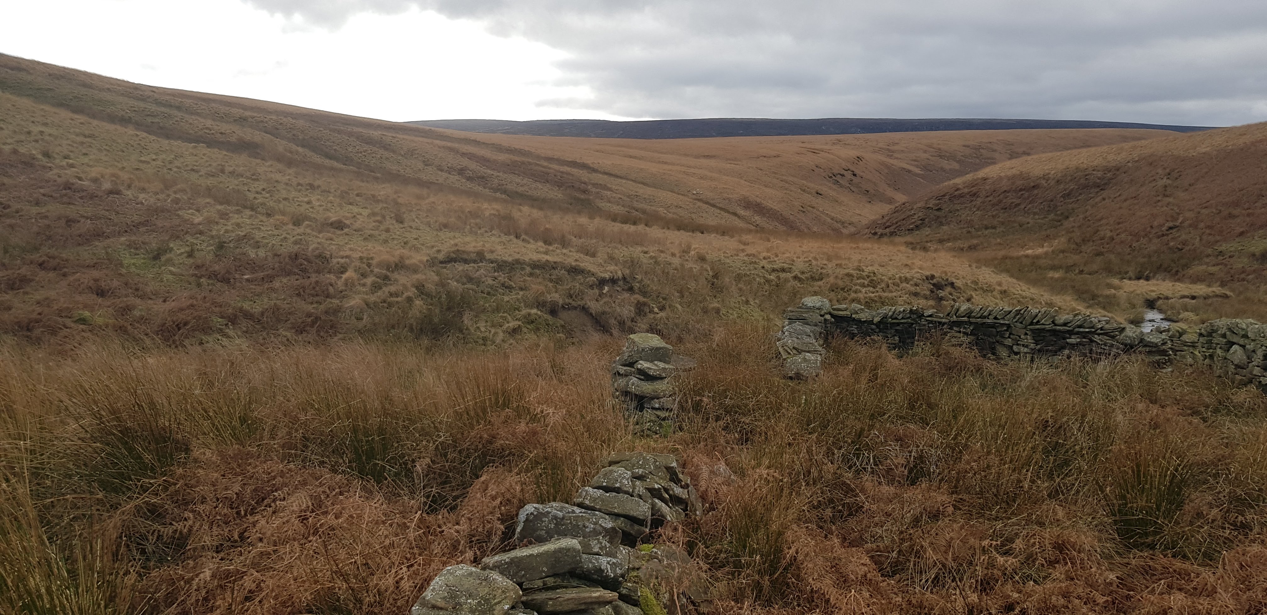
The initial route went up Lightside and across to Wainstones to Bleaklow head. From there, across the plateau over to Bleaklow Stones, Grinah Stones and down Lower Small Clough, past the cabins and into the Derwent valley. A short run down the valley, and a sharp lefthand turn up the hill in Broadhead clough to the top of the hill- where Outer Edge trig lies to your left, and Margery Stones to your right was about on the 2 hour mark.
 |
| All smiley at Grinah |
Across Cut Gate and the first human of the day was spotted, and soon left behind as Margery Stones trig was attained. Now came the beginning of the square bagging.
 |
| Margery Hill Trig |
An eastward trajectory was followed down the moor, past a very out of place bush down into the junction of Stainery Clough and the aptly named Boggery Slades, followed by a fence line just to the north of Eweden Beck, keeping as low as possible in order to graze into the squares. There was a very nice trod to follow for the vast majority of the way around to the corner of a sheepfold that had been earmarked.
 |
| What the hell is that Bush doing there? |
On getting to the wall corner and consulting the map it was decided to drop to the stream and back up again, *just* to be on the safe side of getting the square. Post-run analysis showed this wasn't strictly necessary, but it was good to do it anyway.
 |
| Oh yeah, I stumbled on an aircraft wreck as well. |
3 hours in now- and at the point furthest away from the house- but with a fair amount of "interesting" nav to be done yet. 6 hours would be generous.
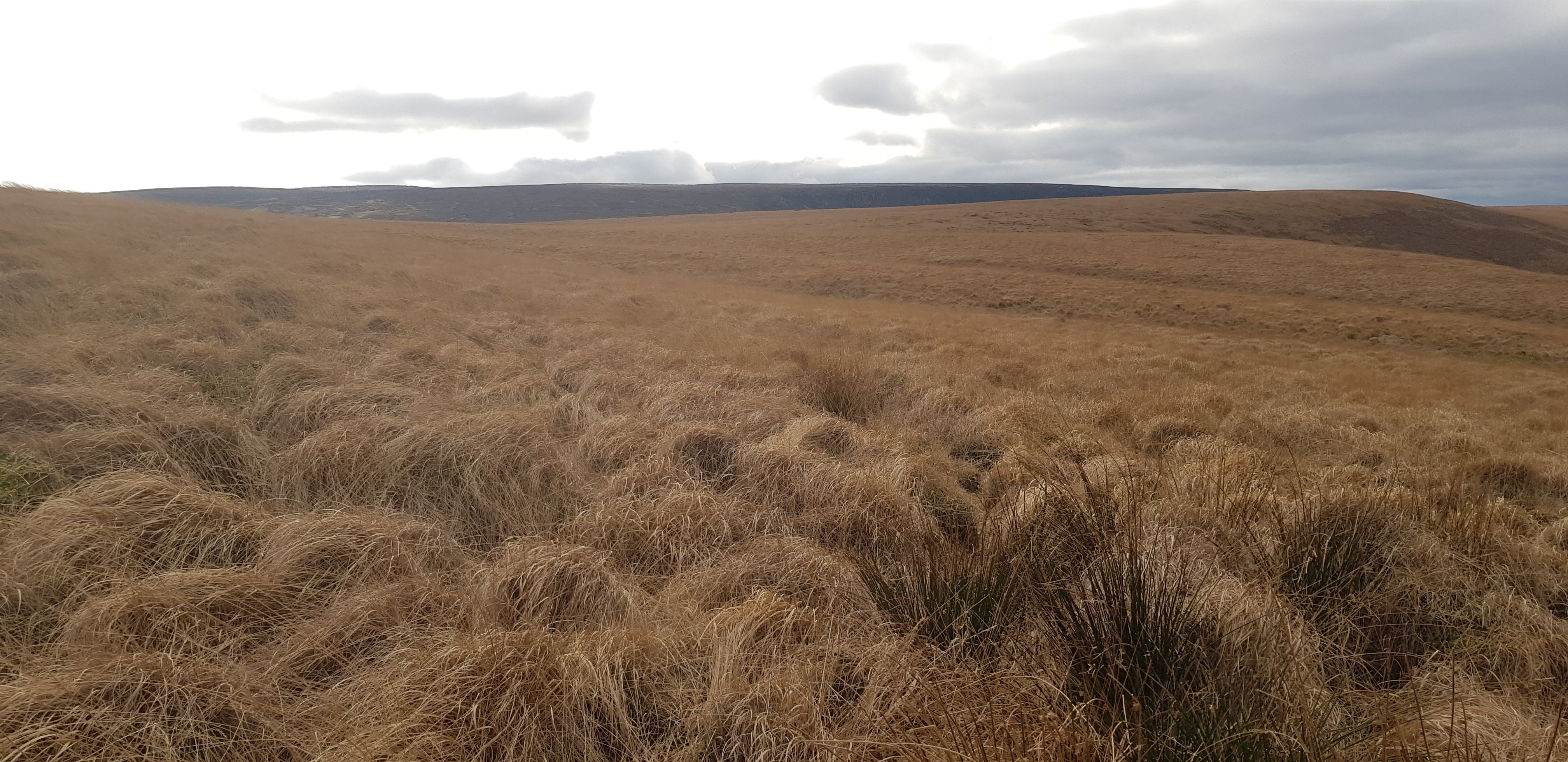
Northwards now, up and over some fairly tough ground- deep heather- gaining an intermittent wall line and over to a junction that was fairly indistinct.
 |
| THIS wall junction |
Slow progress here, but good visibilty- which meant that everything on the ground was pretty well identifiable and nav was relatively easy. From here, a navigational jump from a wall corner to another one across some fairly inhospitable ground with heather and bog made for quite slow progress.
 |
| This is the "wall" junction. |
The wall corner at Ferny Common was a point where the route reckoned on a direct line across to Sudgen Clough.
The ground did not look inviting, and there is a fairly decent trod from Pike Lowe back to the Mickleden Edge path. Oh- and another thing- there was a headwind from hell coming in from the West which hampered progress to a considerable degree.
 |
| "the ground did not look inviting". To be fair, this is looking North. |
Looking at the map now, the hop to Sudgen clough seems totally do-able. On the day, ascending to Pike Lowe was a MUCH better option than hacking across 500metres of thigh deep heather.
So up to Pike Lowe and across the old boundary path back to the Mickleden path- breaking off early in order to go down and across the illegal road up above Mickleden Beck.
 |
| Illegal road. |
(Illegal road, I hear you ask? Yes- it's a plastic road laid down by the Moor owners without planning permission about 5 years? ago, who then sought to gain retrospective planning permission for it- which was refused, (2?3? years ago)- and they still haven't removed it. I suspect they haven't been fined or otherwise punished for walking roughshod all over planning laws... but there you go, that's the problem when your ruling party is a party of Game bird killing enthusiasts who turn a blind eye to this kind of thing.... )
 |
| Illegal road. |
ANYHOW...
Up onto the edge via a very interesting bunch of rocks and some horrendously deep heather, and then a run down a trod to get to Mickleden Pond- a brand new place for me.
 |
| Funky rocks |
 |
| Mickleden Pond |
Then onward down perhaps the worse running line in history to the East of Bradshaw clough where "running" very much took a back seat to "attempting to get through more thigh deep heather than is good for you"- a slow, slow, slow downhill kilometre to a stream crossing and the most well fortified sheepfold in existence.
 |
| A sheep fold with crenellations. I mean... what? |
Now onwards and upwards on "Hordron road", past the second human of the day, and up to the A628. 1230. 5 hours in. Shoes off to get rid of excess internal peat, picked up over the last few miles, the second of 3 gels I have for "extra" energy.... I've been going through food very well so far- but the next section is directly into the wind and up a 2km long hill. Fine under normal circumstances, but this is 30k deep and there is a decision to be made. After the trig point... continue West down the Snow road and back to the Blacks and home- or turn North and do the extension that will get another 5 squares...?
The long drag up the hill is... well... long. Traffic streams past just over the rise on the A628, but there is enough of a barrier not to really take much of a notice of it. Up to the trig point, a quick photo, and, dyou know what? Straight down the Snow Road is only a kilometre less than the extension, so it might as well get done.
 |
| That stupid trig you can see from the A628 |
Idiot.
Northwards on the bridleway (well, through a few turks heads/ peat hags) to the bridleway and then north, up to the road and across onto some of the grimmest running landscape I've had the misfortune to "run" across. First up, a bash across inhospital heather/bog scape to Dearden clough, and a fabulous scramble up a crumbling grough to the grough corner to bag the first of the squares here.
Grouse butts were spied- which generally means some kind of trod, so after a bit of a bash up Dead Edge a very very thin trod was attained- which kind of- but not really- made it's way towards the fence line on Dead Edge End. More heather bashing to get to the fenceline where another trod- dead into the wind and very boggy continued to the trig point. Square 2 on this section.
 |
| Dead Edge End trig. |
Looking at the map, it was suddenly apparent that if I made way directly to the planned sheepfold, a square would get missed. Which would mean having to come out here again. No way. This fence line continued on the ridge up into the missing square, just to the east of Withens Edge, so I stayed high for much longer than initially was necessary before dropping directly into the clough.
Well. Directly.... kind of directly through knee high turks heads- which slowed the pace down to a crawl- but at least it was a downhill crawl. It was a laughing matter, or else it would have been a crying one- and eventually the sheepfold came into sight over a slight hummock. Touch the sheepfold (not fortified like the last one)- and a look south down the clough to the next one. The entire hillside was basically turks heads. The whole thing. Sheep were dotted around, and so there were a couple of trods that were about half a sheep wide (no idea how they did that- but that's the truth) and so very very slow progress was made down the clough to the second sheepfold.
Right. Enough of this now. From here, it is a basic bearing from here to the Blacks carpark. Easy.
Take a sighting.
 |
| Yup. You're going that-a-way |
The terrain you have just been going through was a cakewalk. THIS is where it gets really grim. 44km in, down to the last 2 bars, there is a hillside you have to go up across and over. The entire thing is knee to thigh deep turks heads. There are NO sheep trods. There is no easy way. Have a short talk with yourself, become convinced that if you just go for it, it'll only be about 10 mins and strike out on the bearing.
 |
| There are many words that spring to mind. Most of them 4 letters long. |
This is just step by high footstep slow progress across treacherous ground. Running doesn't happen here. Not even a hovercraft could make decent progress across this terrain. (maybe?). Eventually there is a stile ahead- 100 metres away, yet it takes an age to get to.... and when you get there, it doesn't even go over the fence! At least it marks the high point of this section of Pikenaze moor and it is downhill turksheads to the Northern Horse Route, and the Blacks.
 |
| They put in a stile, but missed the fence. |
All squares (hopefully) got, and a homebound route needs to be decided on. Over Near Black and across Bleaklow, or down the Longdendale trail and back up over Torside? Considering the fatigue and lack of food, the trail wins out, which although it means no immediate hill, it does mean a monotony of steady kilometres to be tapped out to Reaps. The final piece of food gets eaten at the bottom of the hill, and the climb goes as well as can be expected. Heavy legs on the way down Glossop Low, and Lynne has walked out to meet me as I come off the hill.
 |
| Glossop Low. Out of food and water, but just downhill to go. |
Well then. 58km and just over 2k of ascent- 8 and a half hours of foot time- but importantly- ALL the squares got filled!

Now.... onto the next section.....
Oh go on then- have the strava track as well....
No comments:
Post a Comment