Monday, 12 August 2019

Transcambrian- Reverse


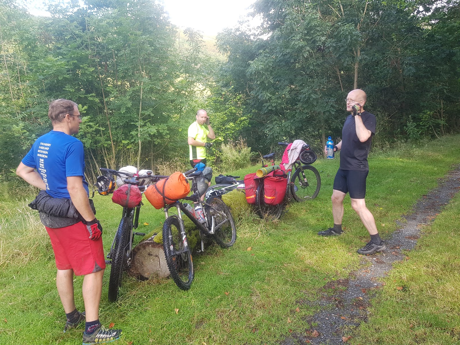
After last weeks debacle of a bikepacking trip where Phil and I ended up pretty much broken, we were faced with the fact that we had already agreed to head off on a bikepacking trip with a couple of mates from Mountain Rescue. The general plan was to do either the Capital Trail near Edinburgh, or the Trans-Cambrian trail across Wales.
The main thing was that there needed to be a LOT more cycling and a LOT less walking than last week and we'd be happy.
When it was planned, we did not really count on the fact that there would be a yellow weather warning across the country for wind and/or rain for half the weekend. Different forecasts said different things, but the general consensus was that it was going to be a strong Southwesterly wind, gusting to potentially about 40-50mph and a fairly sizeable chunk of rain.

Considering that the Transcambrian is normally done East to west, and that is what most of the information online is about, we decided that it would be more intelligent to do it the otherway around and at least have a following wind, rather than a brutal headwind ALL the way. This was going to be a lightweight bikepacking affair with tents etc, rather than a hyperlightweight trip, staying in B&Bs and pubs, so we weren't going to be going hyperfast, but rather, at a fairly decent, steady pace.

As mentioned, the trail is normally ridden the opposite way around to the way we went, so we were travelling up everywhere that is designated as an amazing descent, but at the same time, we were going down all the ups, which was pretty good.
In terms of logistics, it is a non-circular trail (as you'd imagine), and we decided to put the logistics at the beginning of the trip rather than at the end. It means you travel in clean clothes with clean bikes to the beginning of the trail, rather than in manky clothes with crap covered bikes back to your car. We parked in Knighton and got a taxi service to take us and our bikes to Dovey Junction- £25 a head, which was pretty decent- where we were kicked out into a pretty decently heavy rain shower where we set about clipping all our luggage to our bikes and getting ready to set off, whereupon the sun came out for a moment.

The sun came out just after the shower.
We started out down the road and were quickly off the main road and up the first hill. The first few miles of anything like this are basically a bit of a shakedown in terms of what you have and haven't attached to your bike correctly. This was much the case as we worked our way up some fairly technical uphills (as mentioned, they are normally tackled as the last joyous downhills of this route). The main thing that sticks out about the route here was the fact that it rained on and off pretty much the whole way along, and the brisk tailwind proved to us that we had definitely made the best decision in terms of the direction of travel.
To be honest, Phil and I were just glad to be riding bikes as opposed to pushing them! The riding was actually pretty delightful, company was excellent and there was little enough to be told about anything bad happening. General plan was to get about 35k on the first day and camp somewhere near the river Severn, so I'll let some photos do the talking.
Tom on the first decent climb (after the first section of hiking)


Coming to the place that Phil has designated the campsite, the weather continued to be a bit on and off. (there aren't a lot of photos of the rain as when it rains, you don't tend to want to get the camera out). There was a toilet block and a carpark, and luckily the toilet block had a bit of a lean-to thing that we took advantage of and used the shelter to have a bit of a cook up of tea prior to putting up the tents.

Cooking up a storm

It got fairly chilly quite quickly, especially as we were pretty damp and the wind was still fairly brisk, so tents were put up and we bedded down for the night.
It rained. It was crazy windy.
Finding fresh water was a little bit of a problem, and if I was to do this again I'd probably take some steri-tabs. We were quite lucky last week as any water source we came across in the Lake District was clear and potable. This was certainly not the case here in mid-Wales.
Across the Severn.
Day 2 started with the first of the fords within about 2 minutes of leaving the campsite. Any ideas of keeping feet dry were swiftly kyboshed, and the scene was set for the next 80km.

Quite a lot of it looked like this
Wet, but very rideable tracks with some excellent down hill sections. 

I didn't get many photos of the downhill bits, simply because by the time I got to the bottom there wasn't enough time to get a camera out to catch the others.
After about 10k the rain started to get REALLY bad and we arrived in the hamlet of Llangurig. It was a couple of k out from the route, but we figured it would make a good stop off should the weather get really bad.
It did, so we stopped for a cup of coffee.
And a cake.
and it rained.
So we had a panini each.
And another hot chocolate.
and eventually carried on when it seemed like the worst of the weather had gone through.
The trails continued to be excellent, with a number of fords to be crossed. We rode for the vast majority of the time, but ended up pushing up some of the steeper sections. 
We stopped for a version of lunch in the middle of a forest where, had we been going in the other direction, there would have been some excellent downhill single track.
Lunch stop
As you can see from the photos, it was still pretty damp. The section after lunch was a bit into the headwind, and then a turn and a straight run west with the wind behind us down to, and then along some reservoirs.
It was at this point when we realised just how hard it would have been if we went the other way, and a lot of grinning was to be had as we battered along roads at 25kmph while feeling like we were being pushed along from behind.

This isn't a ford. It's a puddle.


Down and past the reservoirs we came upon a section of bridleway that was obviously used for offroaders as well. The surface was pretty torn up, and as we had been going through fords for most of the day, we just decided to blast through the puddles in the track as well. This was one of the parts of the route where we were very very glad of the decision to be on mountain bikes rather than gravel bikes. Yes, gravel bikes would have coped with it, to a point- but not with the amount of luggage that we were carrying.


We eventually came down the way towards our camp for the night- in Rhayder where we got a pitch on the Camping and Caravan association campsite, which meant a shower and toilets! The final section was a delight of bike tracks that we just tootled down with very little effort. Staying in the town also meant that we treated ourselves to a pub meal in the evening as well, which went down very well after 80km of offroad riding.
To be honest, there was a fair amount of backroad cycling going on as well, but I would much rather that than the option from last week which was struggling up "bridleways" that were no more suitable for bikes than they were for horses.


We woke up to day 3 feeling pretty refreshed, and although there was a bit of drizzle in the air, and the temperature was a little colder, we were very much up for the final 50km.
As we rode further East the trails became easier and less challenging than that which we encountered on the first day. There were still a couple more fords to cross, though, which didn't cause any problems at all.


Final ford of the weekend


 Our final stop for the day before getting back to Knighton was in Llanbadarn Fynydd where there is an excellent local community shop. Very welcoming staff who was perfectly happy for us to heat our own food up in the microwave (we didn't), and had an excellent stock of food and other stuff as well, which we took advantage of.
Then it was onward and upward to the final few hills back to Knighton.


This was an excellent trip out, and I can highly recommend it as a Mountain biking route. If you're going to do it on gravel bikes, make sure you have as thick a tyre on as you can and don't take much luggage- go fast, light and stay in B&B's etc rather than tent.
Waaay better than the Lakeland 200, which as we have been discussing, is probably meant as a challenge to see how hard you are, as opposed to having a decent weekend out on the bikes and enjoying yourself.
In all, I think we probably only hike-a-biked for less than 1% of the route. There was a fair amount of road in there, maybe a bit too much for some people, but it was a welcome relief from some of the other sections for us.
There was only really one big fall, no real mechanicals, and a lot of laughs.
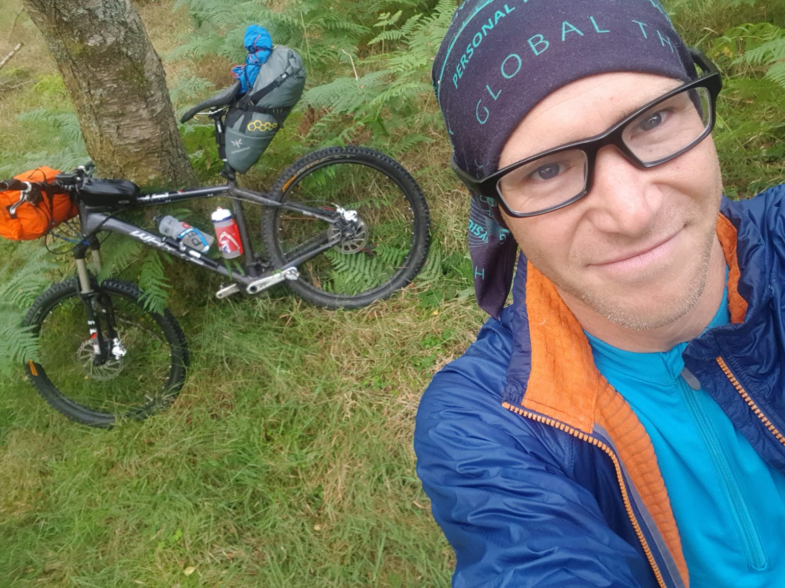
Main navigation was done on a Wahoo Element Bolt with back up on Viewranger, I did it on a 26er while Tom was on a 650b+ (and certainly had the most fun), Phil was the only one on a full-sus (and on 650s) and Chris was on an old 26er with Panniers.

Had the weather been a bit better we might have considered doing it over 2 days, but I reckon we got the most out of it over 2 and a half. Great weekend out. 


Monday, 5 August 2019

Lakes 200 with Phil

"epic adventure" was the title of the email.
We both had some time off on Friday afternoon and Monday morning, so a trip to the Lakes for a bikepacking adventure seemed like a good idea. Phil had picked the Lakes 200 as a route- a 200km epic mountainbiking loop around the Lake District. We figured it would take up to 4 days to do it, so we would go pretty easy, packing light, but still sleeping in tents. The forecast was not great, so it could have been anything from sunny to stormy.

Having got to Staveley in the late afternoon, we packed the bikes and headed off into the distance. The tracks were delightful, we swooshed along out from Staveley along back roads and excellent Bridleways, across to Ambleside, over to Chapel Stile, Elterwater and down to Hawkeshead. Wonderful cycling, good chat and consistently good under tyre surface. We met a couple on Gravel Bikes doing their own kit shakedown prior to a trip, who expressed some doubts about the route we were on... it being quite arduous... we merely laughed it off and said we'd be fine.
We should have listened.


It was just dropping dark as we came across a bit of a spinny just before High Wray. A surreptitious camp in the woodland, out of sight from the track was made, and the night was spent in comfort.

We were both trying out some new kit- so a bit of a shakedown in terms of what works and what doesn't. Phil had a new tent, sleeping bag, sleeping mat etc. etc. so he was definitely the one with most things to try out. It seemed that it all worked well.
And I thought this was packing light.


The next day dawned brightly and we were hopeful of how the day might turn out - Keswick was about 100km away, so that seemed like a fairly intelligent target. The section through Grizedale was great and very rideable - Phil had done the first section before and so we knew that directly after Coniston there was quite an arduous hike a bike section up and over the hill. With that in mind, we stopped for a coffee and cake in Coniston before starting the quite frankly, ridiculous 30%+ hill to the bit where we had to walk.


As we hiked up the hill it seemed like hard work, pushing the bikes onward and upward - but at least there would be a decent downhill at the end.
A number of walkers passed us on the way up, and we were pretty slow, sweating in the sun. Tangfastics were used to stave off cramps, and it was with great relief that we topped out and looked at the marvellous descent in front of us.

Down we went, smiles and delight, until getting to the bottom, I realised I couldn't unclip my left foot. Oh no. Um... slow down, dont panic - unclip rightfoot and stop...
Left foot still attached to the pedal. Comedy ensued as Phil undid my shoe laces in order to get my shoe off as I was semi-sprawled across the floor. Having levered the shoe out of the spd it became apparent that one of the bolts holding my cleat on had fallen out, and the other was very loose indeed. Minor catastrophe.

Looking around at other things on our bikes, Phil found a countersunk bolt holding his navigation clippy thing together that was the right thread, so that was pressganged into action on my shoe... cleat fixed, on we went, a long and very hot loop around to the south of Caw, and then eventually up to the gorge crossing on the Duddon where we stopped for lunch and a dip in the river. So far, so good, we'd had a fair amount of riding, food was good although it was hot, and after being suitably replenished, we got on our way.

Almost immediately we were back to hiking while pushing bikes through some pretty crappy ground, although this wasn't too much the case as we cycled most of it over to Hardknott, and then down the road a short way before taking in one of those pointless bits which is not particularly interesting or inspiring, it is simply a way of making the route longer so that it can be 200km.
By this time it was about 3pm and we were fairly heat struck, so took a while to get off the bikes and just lie in the shade. We knew the next bit was probably going to get worse.

We were right.

Out of Boot and up over to Wasdale was mostly pushing bikes up hill. The main redeeming quality of this was the view at the top as we came down into Wasdale Head. I've never really been cycling anywhere with views like that... and it was cycling at the expense of pushing a lot of stuff up a hill.
A delightful descent into Wasdale and it was 630pm, we decided not to stop because the next hill was Black Sail pass, and we wanted to get over that before camping.


Beautiful views

We had decided a while back that getting anywhere near Keswick was not going to happen today because of the ridiculously slow progress we were making on the hills. Camping at Black Sail, or, optimistically at the top of Scarth Gap before the descent to Honsiter might be possible.

So we went up Black Sail.
And this was an *easy* uphill section


Really doesn't do justice to the fun we had.

Who on earth thought that putting massive stone steps on a Bridleway was a good idea? Actually, who thought that this as a Bridleway is a good idea. At least up until this point the hike-a-bike had been mostly pushable with a couple of lifting the bike up and over some rocks. This is basically lifting your bike up and over everything all the way up. This is slower than walking. This is totally pointless, especially when you consider that you're going to be so knackered by the time you get to the top that cycling down the other side is not going to be an option, so you'll be walking down it as well.
By this time I was losing interest in the Lakes 200 as a route. Anything with this amount of hike-a-bike in terms of push/lift in comparison to actual riding is pretty damn pointless in my opinion. I'd have been faster running.
Heck, I'd have been faster walking.

Eventually the purgatory of going uphill ended, and the slightly different purgatory of going downhill started. Too steep to ride, too rocky to negotiate safely (especially in the state we were in), it was a walk down into Black Sail where we eventually found a sheepfold to camp in. I was pretty adamant that I didn't want anything more to do with hike-a-bike, but we resolved to come up with a plan tomorrow when we got to Honister Slatemine for a coffee.
In the meantime, food was consumed, midges were cursed and we fell into deep and dreamless sleep. It had taken 13 hours to do 67km.

There was a small amount of rain in the night, but nothing to worry about, and it was fine in the morning. Having had a fair amount of sleep, we were both waking up with various aches, pains, bruises and general uncomfortableness.
It took a while for us to get going, probably because we knew that within 10 mins of starting we would be back to pushing the bikes uphill again. And we were.
Scarth gap. Another hike section that involved lifting bikes up and over rocks etc.
At the top a guy came past us on a single-speed(?!) who had spent the night in a silk liner and a bivvy bag. He was packing REALLY light and was in better spirits than we were.

Having said that, the descent down into Honister was another walking descent and we passed him again on the way down. I was expecting to see him again as we went passed us later on, but we never saw him again.
Now for the big road climb of the day, up the pass to Honister Slatemine. I was very glad of the ridiculously low gearing I had on the bike, and also incredibly glad that I was ACTUALLY riding the bike as well. Up to the Cafe at the top of the pass and we got out the map.

"We made a mistake really", said Phil... "when we decided to come to the Lake District". By this time we both knew that completing the loop was not going to be done. Any more hikes for the terrible downhills we had been experiencing just wasn't going to cut it, so the options were basically mashing it on the road up to Keswick and then down the roads to Ambleside and then back to Staveley. Not nice, especially when you consider the volume of traffic on the roads and the high quotient of pillocks behind the wheel.
The other option was offroad - along the bottom of a valley and then pushing up and over Stakes Pass and into the Langdales, before cycleways back to Staveley. That option won out.

So down, a right and then a right at Rossthwaite. What followed was basically 10km of walking while pushing bikes up a valley that *might* have been rideable if you weren't tired and had a lightweight 29er, but on a loaded 26er, it wasn't.
Yes, that is a bridleway as well.


See all that path? Yes. Not rideable.
Then up Stakes Pass, were I decided that we'd literally come on a walking holiday while pushing bikes. Then, we pushed them downhill into the Langdales because that wasn't rideable either.
Rubbish.

The final section of the trip home was much more pleasurable as we actually got to ride our bikes along bridleways that you could cycle on. At Ambleside it rained- as in RAINED while we bashed along the road with a vast amount of traffic, before turning off and heading over the hill back to Staveley on delightful, rideable bridleways, and then we collapsed at the van.

The kit we used was excellent. I enjoyed the overnighting in various places, stoves etc worked well.
The route was horrendous. It was the equivalent of the Pennine Way. Some lovely bits of the world joined together with a number of really crap bits which serve no purpose other than to make it longer. The only way I could imagine doing this trip in the suggested 36 hours or so is to do it on a hyperlight 29er with a single waterbottle and a credit card. That is quite a high bar for entry.
To those that have completed it, I doff my cap to you. You have high levels of suffering on a bike that I am in awe of. 

Right now I'm done with anything that involves pushing a bike for extended periods of time. I bought a bike to ride, not to push. A bit of pushing to get over a particularly stubborn bit of trail, fine. A 5 min push over some gnarly terrain, not a problem. Any bike packing from now on is going to have to be on actual, rideable trails or roads. I can't wait to ride an unladen bike again!

Monday, 1 July 2019

Arrochar Alps 2019

Potted summary of the race written while waiting in traffic on the way home....:
The 4 horsemen of the glosspocolypse headed to Arrochar, just north of Glasgow for this delightful little race which is 277,777 battered Mars bars long and has 20869 cans of irn bru of ascent
Here's a bullet point list of quotes and things we learned.
1. Findlay Wild does not look like that.
3. Scottish tussocks are easier to run on.
7. Thunder travels at the speed of sound.
8. Everywhere in Scotland has a castle. Even caravan sites.
10. Midges are lovely around these parts. Less like being bitten, and more like having a massage.
14. Just because you live in Scotland doesnt make you any better at going up hills. (according to Angela mudge)
16. Weird moaning cows
17. Carnivorous plants
18. Frogs everywhere
19. Jamie nearly got struck by lightning
20. We can't count. 
"next time you have a 'good idea' at the Christmas do, make sure I'm on the other side of the room".
It seems that Glossopdale Christmas parties are the place where running, alcohol and "good ideas" come to meet. Daz ended up doing 365 ascents of Cockhill in a year after one such occasion. This time around it seemed that it would be a good idea to do a decently long fell race in Scotland in honour of our late Chairman, John Hewitt.

race prep
Arrochar Alps seemed like a good choice. Long, lots of climb, few people and plenty of adventure. (I must note that we didn't go the whole hog and enter the Larig grhu the next day on account of having an ounce of common sense between us, but there you go).

The Arrochar Alps. Just north of Glasgow. 27km of course, 2400m of ascent. 4 munros. An average of 30 people enter every year- so generally not a great course to do if your nav is not up to snuff. Imagine our disappointment when we found out it was a Scottish Champs race this year! 170 people signed up for it on SI entries- I believe that about 130 eventually turned up to run it. However, the "large" number of entries in no way detracted from the event: it was wall to wall type 2 fun.

Having been watching the weather with interest and trepidation for the last few weeks, the day dawned cool, soon to be humid, with vast tracts of rain forecast. The rest of the UK might be basking in record temperatures, but we were in for some precipitation, and no mistake. The (very midgey) pre-race briefing went along the lines of:
"there are thunderstorms forecast. The marshals are on top of the hills and have been told to get off the tops when they deem it unsafe to be there. Mountain Rescue have said we should be ok, however, if it starts with the lightning, it is up to you to do what you want... personally I would get off the hill, especially as the marshals probably won't be up there anymore. Whatever happens, make sure you tell someone at race HQ that you're off the hill".

Lovely.
So with my race number pinned to my shorts, killing as many midges as possible (and Andy saying... oooh, these midges are really nice. It's less like being bitten and more like being massaged), we set off with a massed crowd of runners.
Being massaged by midges
The first bit of the race is along a single track path, which makes things fun with larger numbers of competitors, though is probably fine with normal low levels of runners. To be honest, I think everyone was fully cogniscent of the hills to come and there weren't any impatient "get out of the way" type people anywhere.
A lovely 5km bimble along an undulating path followed, with us getting warmer and warmer as the humidity took over. Matt thought we passed Finlay Wild along there. We definitely did not.
Path to the dam

We were longing for the climb to get out of the stifling valley.
Not to worry, it was soon upon us.
Current state of the initial climb

Along the track, from single to double and then a right hook up a steep, rocky path into the mist. Finally! A breeze came in from the north and we began to cool as we climbed. A number of runners took a different, steeper grassy line to the left. We stuck to the path having seen that the winner last year seemed to do that on his route- and we were rewarded at the top by coming out marginally ahead of a couple of runners we were with at the bottom. Much of a muchness then.
Still on the initial climb. After sending an SOS...

Taking out my phone for some photos, I managed to inadvertently send an SOS message to Lynne. Well- the climb was big, but it wasn't THAT bad. So I hurriedly send badly spelled text messages to her saying to ignore that, I'm just taking photos, while still climbing as hard as possible. It was surprising that there were so many people who were suffering on that first climb. In my head, all scottish runners eat hills like this for breakfast. Apparently not.

Up into the clag, and Matt went past me as my legs started to complain about going from sealevel to the top of a munro in one go, and it was all I could do to hold onto his coat tails. Through the murk we saw the front runners come back to somewhere around the 854 contour to drop to the dam... didn't see anyone actually take any trod though, so it was going to have to be guess work. 20metres of vis hampered our ability to find the top slightly, but we got there, touched the cairn and came back to the marshals in the tent who had no trouble at all seeing my number attached to my shorts, and we made our way back along the top in the clag to somewhere around the place that we might want to go down the hill.
Yay! descent lines!


It's claggy, all you can see is me and matt, and a hillside that drops more steeply than anything in the peak district, steeper than the descent off scafell pike in the OCT, and no idea of quite what is below. What else to do than to just plunge.
So we did. Down and down until eventually we came out of the cloud to see the dam slap bang in front of us. Bingo!
Look! it's a dam!
A shettlestone harrier who we were with earlier was on another line and well below us- evidently a much faster line... but even by now Matt and I were less in race mode and more in "lets just get around this monster" mode. We could kill ourselves on the climbs and still the locals would breeze past us on better descent lines that were unbeknownst to us.

Down to the dam at 230m, over a gate, along the dam and, whaddaya know- we've got another munro to head up.
Slowly bust surely we tracked down the Shettlestone harrier, and followed a trail of people to the top. A Carnethy lass outclimbed us easily. No, it wasn't Jasmin. It was Angela Mudge. (who else?!)
This climb was amazingly steep, up grass and bog. Hands and feet stuff- and at times I was wondering if I was getting elbow tendinitis from pushing on my knees so much. Once more we ascended into the clouds, munching on haribo, trying not to think about cramp. Towards the top it cleared and the views across the hills was astonishing. Looking at the line on strava it would seem that we took a somewhat sub-optimal route, but to be honest, the fact we got to the top was a triumph at that point.
Marshals at the top

... doesn't really do the view justice

The marshals took our numbers and off we went, down the hill. I was a little confused about where we were going next as there didn't appear to be anyone on the hill in front of me, and it took a bit of brain power and compass work to figure that I was looking at the wrong hill- and it fact I should be looking more to the left... ah - THAT hill.
An easy run off got us to the bottom and then another gruelling thrutch up to the top of our 3rd munro of the day.
Grassy bog. Slippy underfoot. Frogs. Carnivorous plants. Climbs so steep your nose is touching the ground as you're standing upright. Yes, this is Scotland.
Nose to floor climbs

As we approached the top, far away we could hear a faint, deep grumble... big jet? Thunder? Yes... thunder- but still a long way away- we were reassured by the marshals, who looked at the numbers on our shorts, marked us on their records and cheerfully sent us on our way.
Hux


Oh, great, that's ok then.... Where is the next top- aha- over there in the mist. Make sure you don't end up on the Cobbler- an easy mistake to make.
Matt and I plunged down the hill on gradually fatiguing legs in approximately the right direction, into the col, through a gate and then up the hill to the final Munro of the day. Towards the top there was a small amount of scrambling before the plateau, where we found our last marshals of the day.... and heard a slightly more significant peal of thunder whilst looking at some particularly freaky waveform clouds....
Mutual agreement. Let's get off this damn hill!
Have you seen those clouds? What the heck are they? BOOOOOOM. Let's get off this hill.

A run down to the next level, and it became apparent just how our perspective had changed through the day. We knew we were looking for a path, but considering the crazy steepness of the route so far, we found ourselves looking down an almost sheer cliff thinking "yeah- that looks like a sensible line"- when out of the mist to the right there was a REALLY obvious path that was no-where near the ridiculous line we were vaguely ready to throw ourselves down... AHA! it's over there.

Down a slightly less ridiculous path, to the next col where we had the choice... follow the path, or take a totally non marked descent that might or might not work.
We were definitely tired and took the boring option of the path. In hindsight, we should have taken the other line, but also in hindsight, I can see that we were both pretty done in and wanted an unmistakable line off the hill.
The path is horrible.
That's all you really need to know.

Down at the bottom I nearly snapped my knee backwards as every muscle in my right leg rebelled and cramped, which resulted in a few choice words, but we hit to final track and were in the last half mile when the rain turned into a truly torrential downpour. Ridiculous amounts of rain cascaded from the sky as thunder and lightning played across the area. (Andy and Jamie were still on top at this point- the rain was apparently hail up there- and Jamie was encouraged off the hill by seeing lightning strike on the hill *below* him).
Matt and I ran into the finish- which was about as low key as you can get. A bloke with a clipboard, in a mosquito net. Awesome. That just about sums up the entire race- epic, but low key.
Post race irn bru. That's real nutrition.


The scran at the end was excellent. Soup, tea, cakes (for a donation). Finlay Wild won the race in a scarcely creditable 3:07 (and was still 20 seconds outside the record)- we were about an hour slower, but I have no idea about our places.

Basically, this is a little like a Grassy Jura, but in reverse. A long flat 5k section followed by some monstrous ups and downs. As good as Jura is, I have so say I prefer the Arrochar Alps as a race. I hope to be back to to it again next year- maybe with a bit more training in my legs... a sub4 here would be a good day out.
Huge thanks to the organisers and the marshals. Total legends.